For a long time now I have been fascinated with 3D maps - something tactile that you can touch and feel, and understand the scale of a place and where you fit in to it.
This project took about 6 months to work through from start to finish - and I still consider this a First Draft, and am already planning its successor.
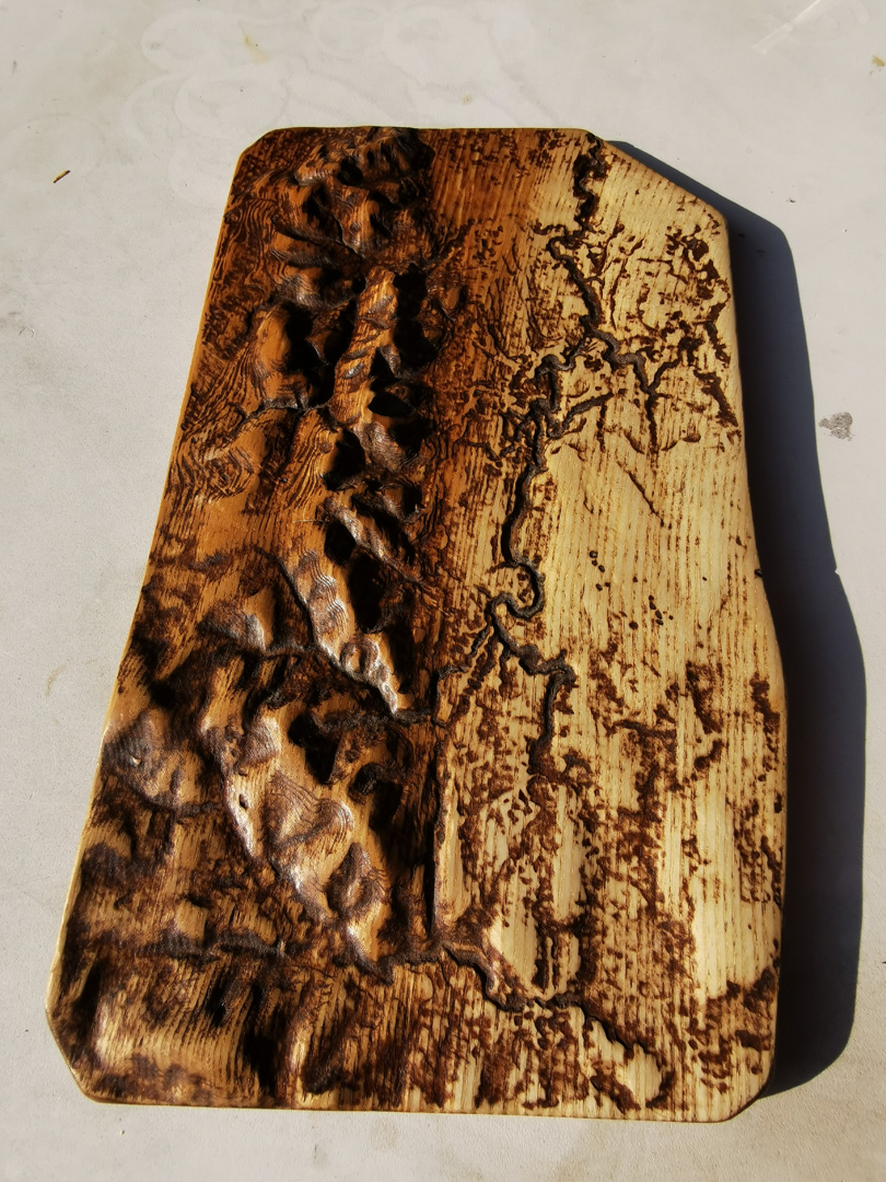
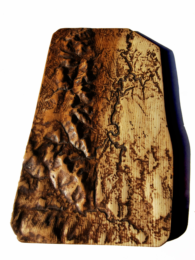
Using radar height data captured by the ALOS2 satellite and some clever software from Iowa State University I was able to create a 3D model of the Pentland Hills, from West Linton in the South to the Edinburgh City Bypass in the North, with the East and West directions covering, very roughly, the region from Harlaw in the West to Roslyn in the East.
The next phase involved much editing and refining of the 3D model - fixing holes and gaps, adjusting scales and heights to make things look right and so forth. This was a very long and involved process, made even harder due to the sheer size of the data file. There is an awful lot of geography in those few square miles!
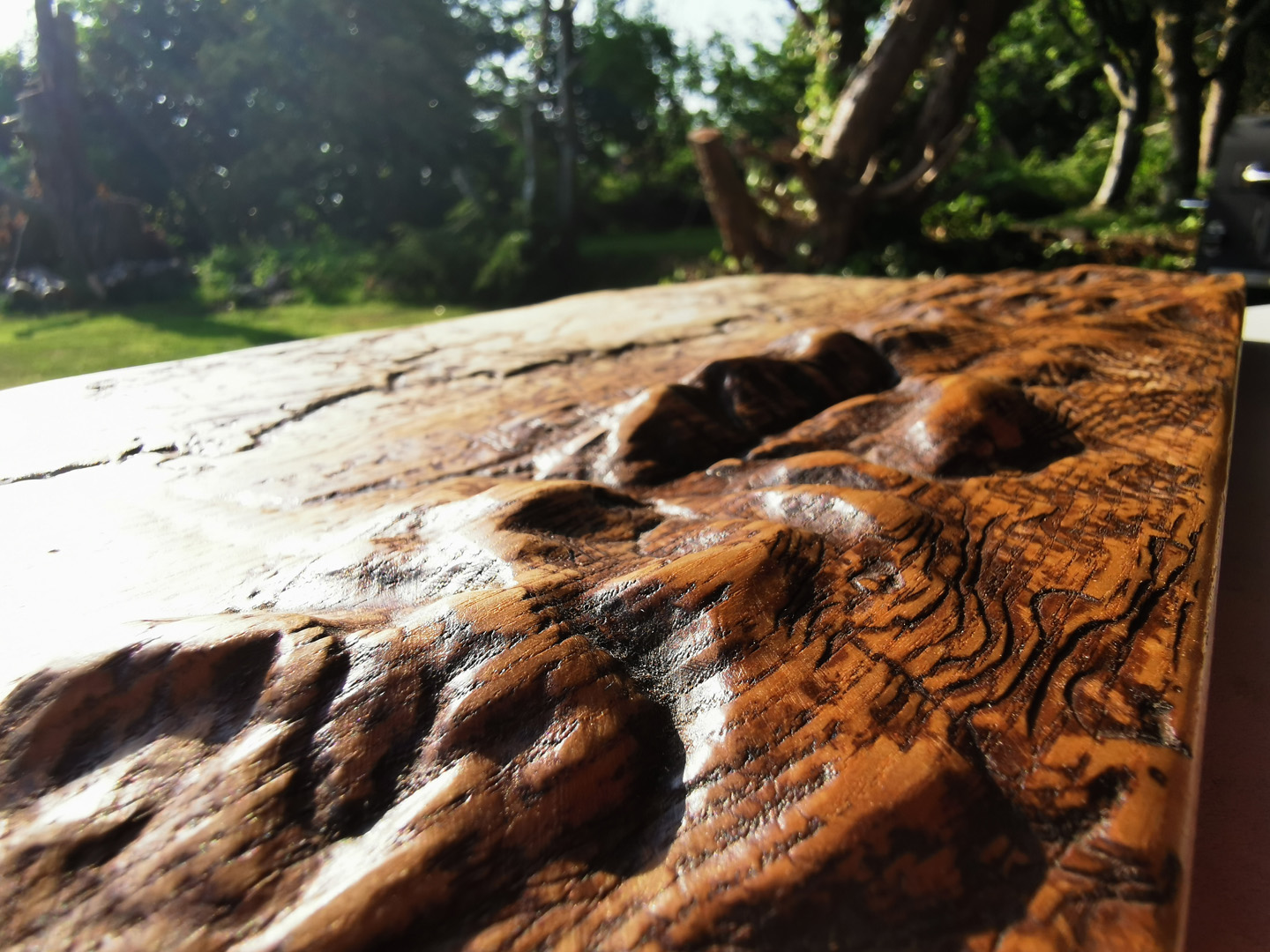
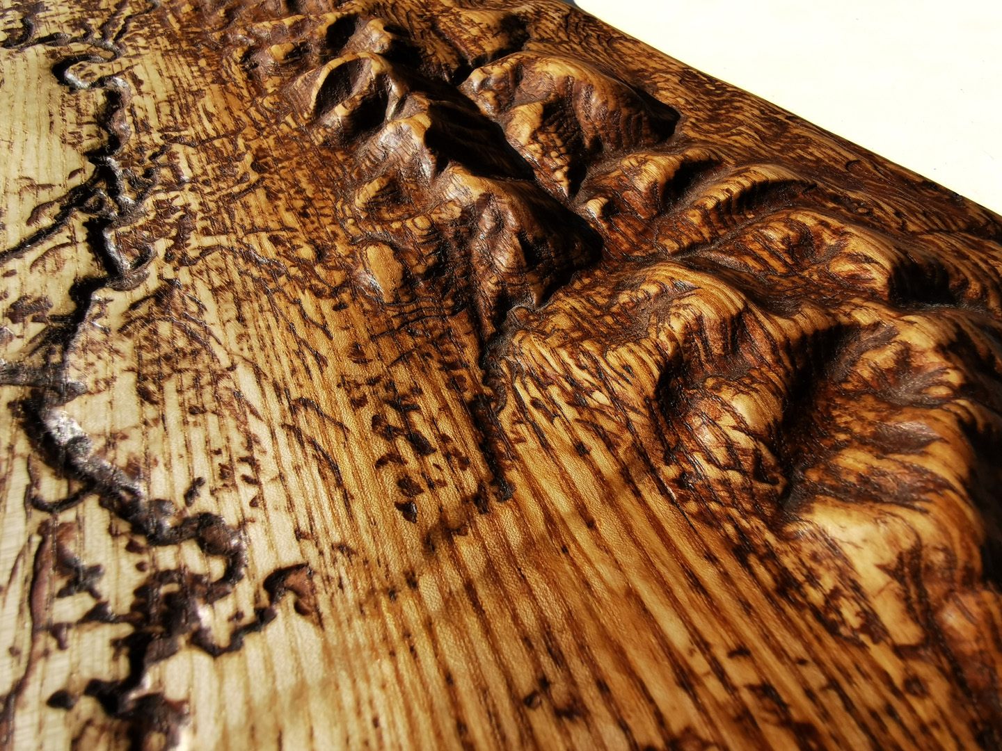
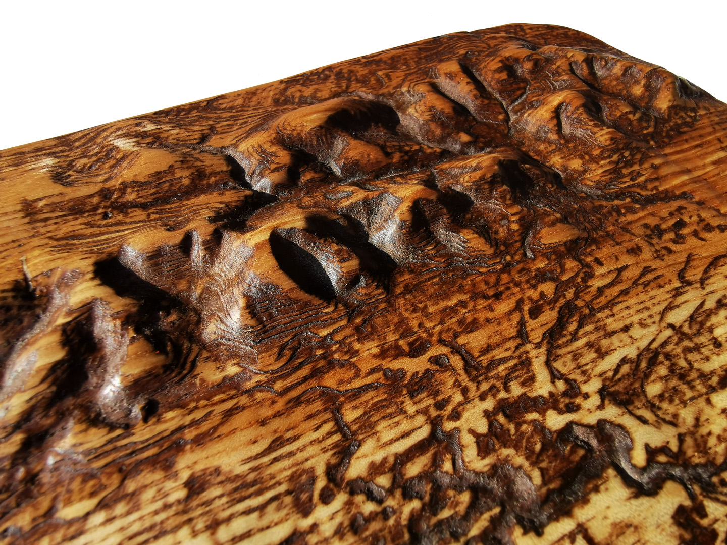
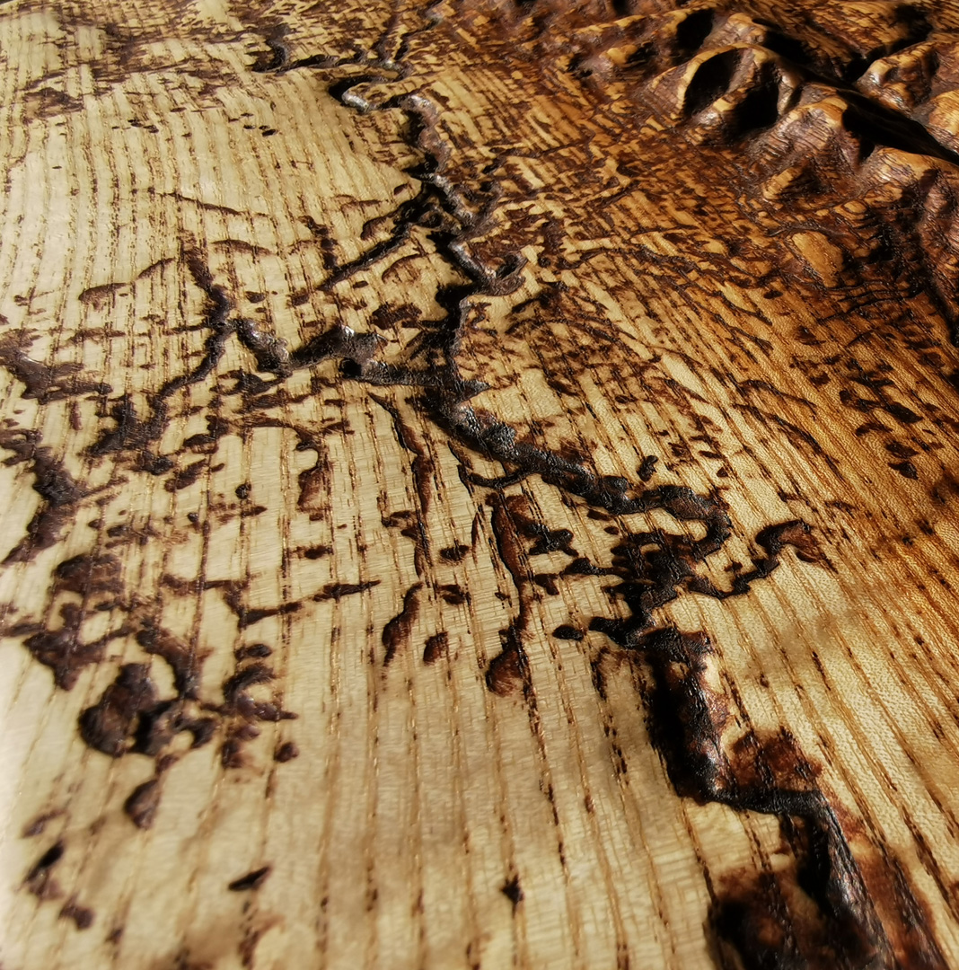
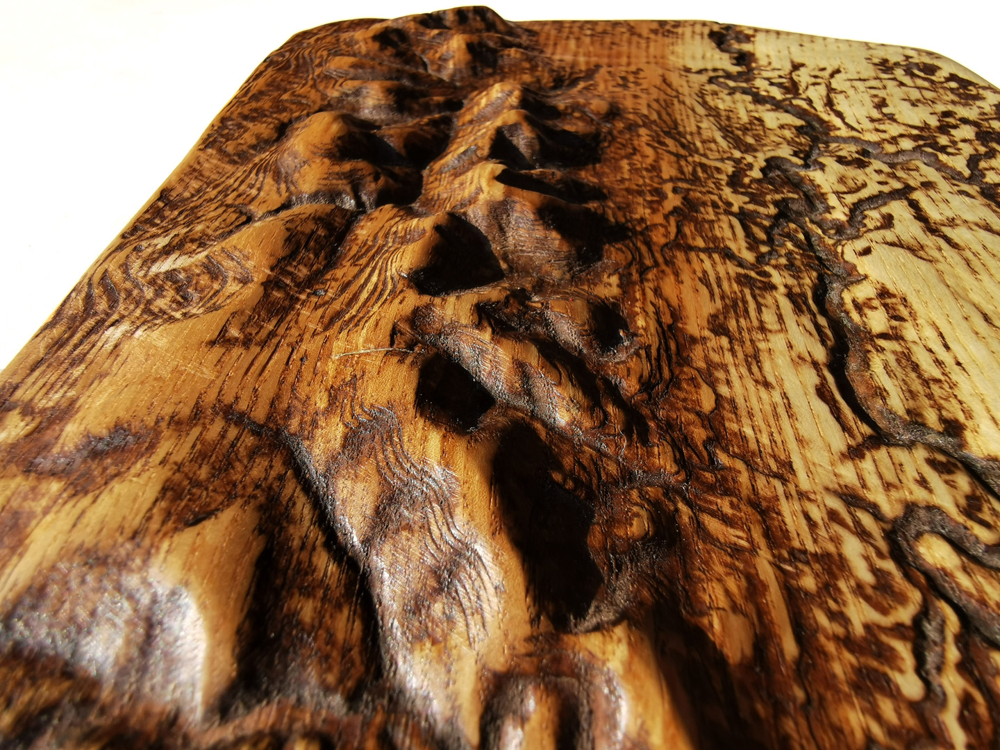
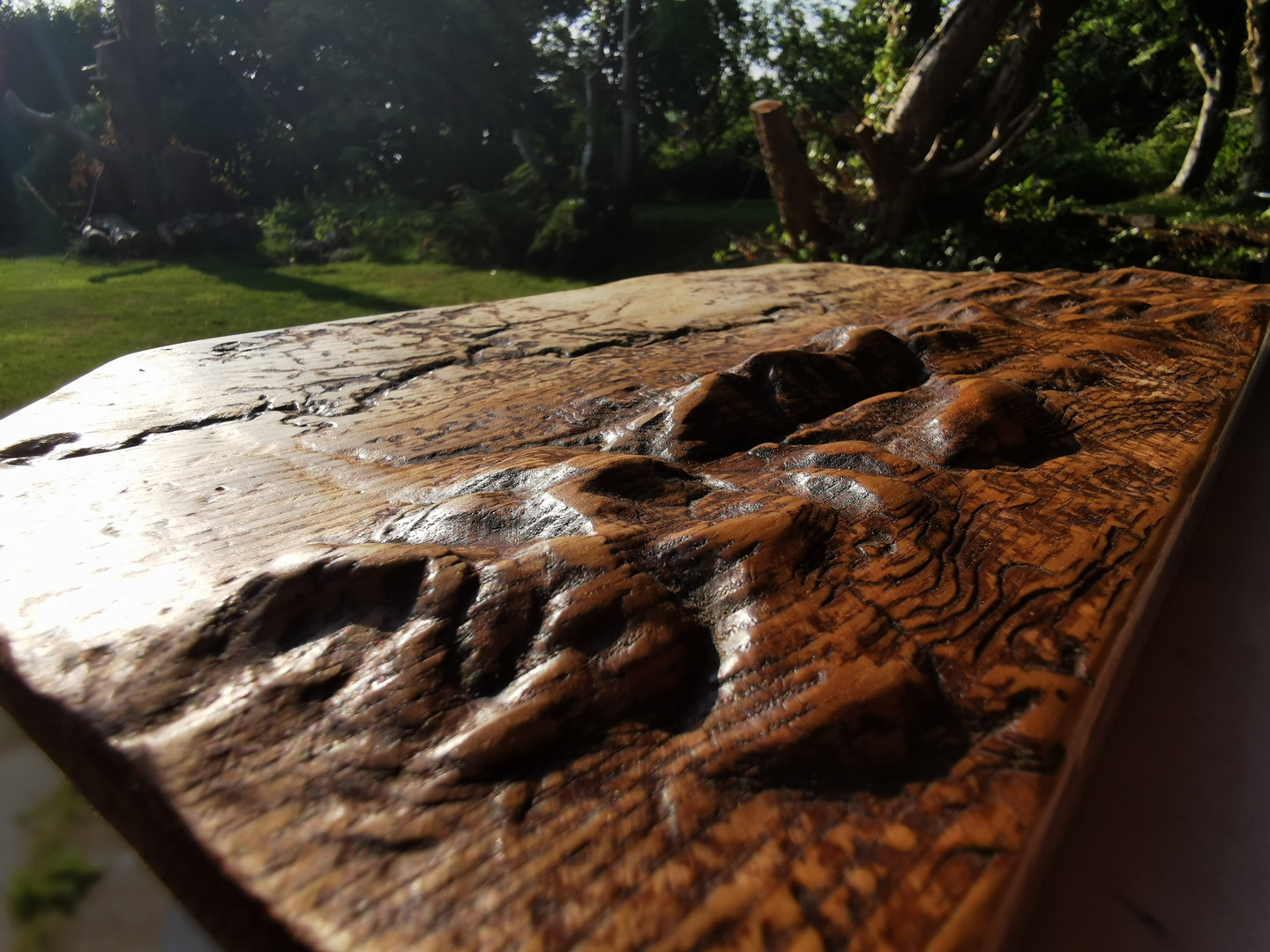
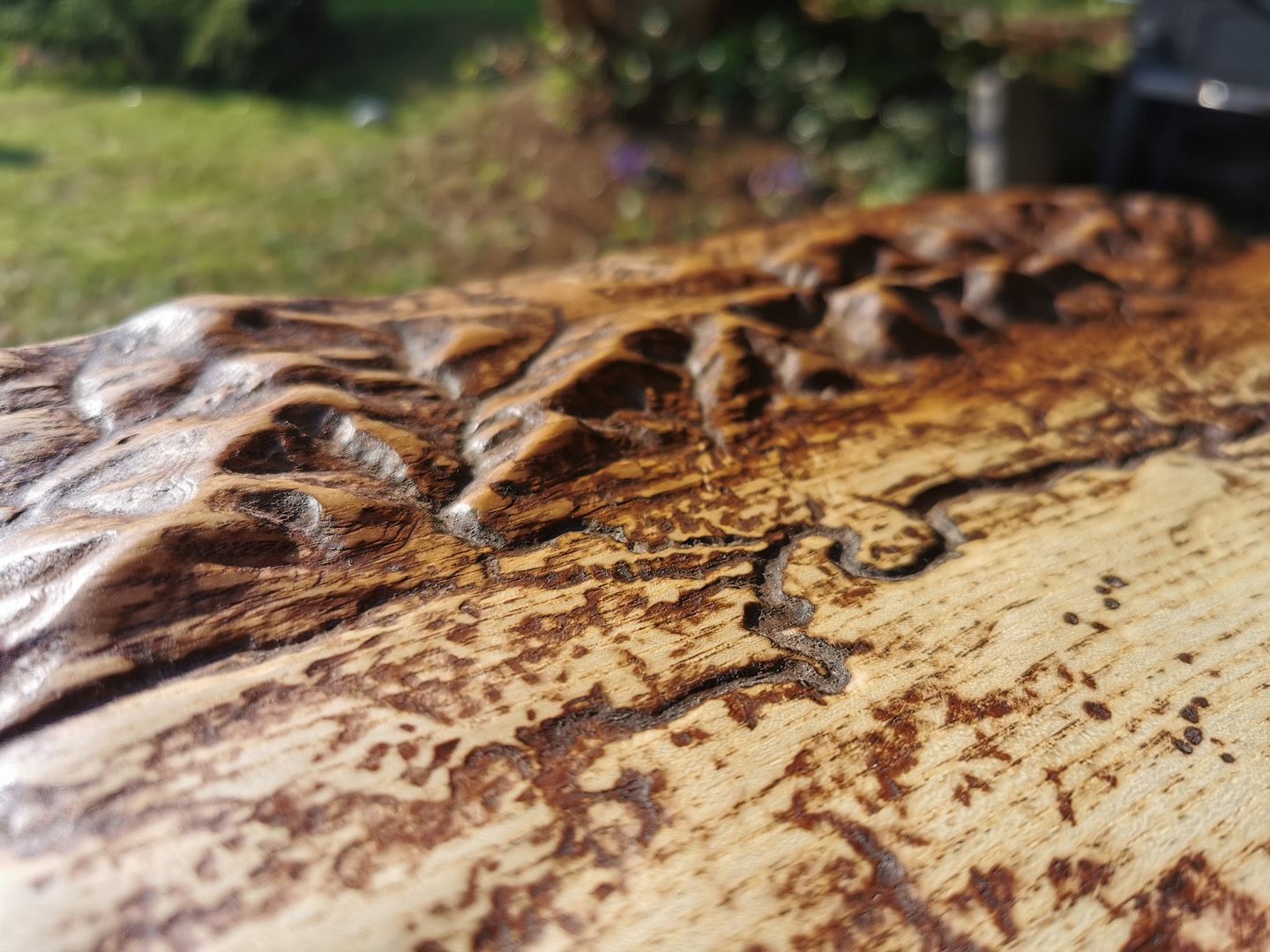
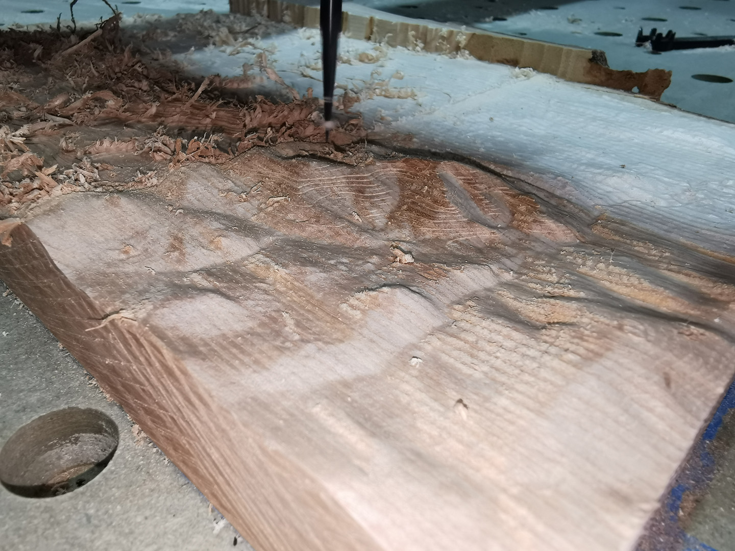
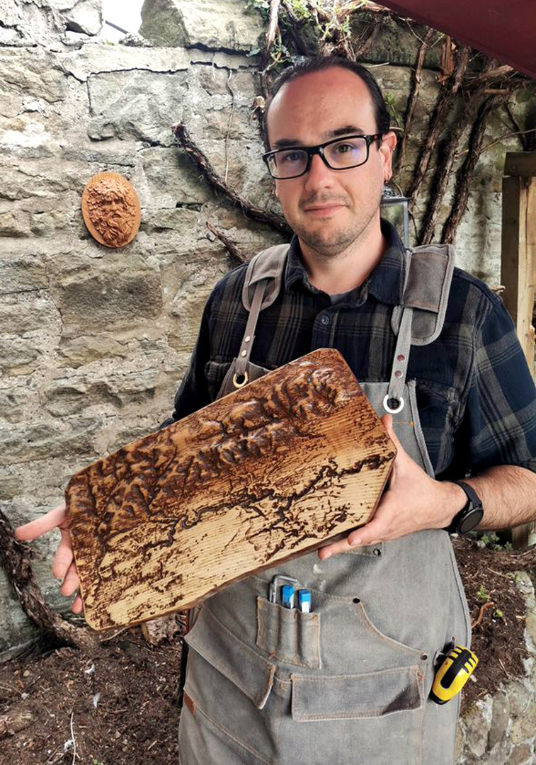
Finally happy with the model I set about carving it out on the CNC. The piece of Ash I selected had a darker heartwood section which I aligned with the hills, leaving the lighter half for the valley side where the River North Esk can be seen in the carving.
This part took time. A lot of time. A hell of a lot of time. Carving Edinburgh's local hills into wood is not a quick job, even when it's computer controlled. The total machining time was well over 30 hours, however it took a few weeks to complete as the motor brushes wore out on the CNC Spindle and I had to wait for replacements to be shipped out from a supplier in Germany!
I think it was worth it, although Version 2 is going to be a lot better.
-Ben